
Gradient Array
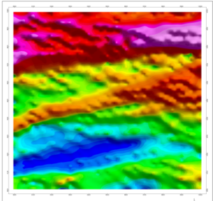 In gradient array surveys, the apparent resistivity data maps the subsurface structures and lithology based on their abilities to transmit electrical current whilst the apparent chargeability maps the disseminated sulfides. Data is collected with 10 channel Elrec pro receiver from n=1 to n=10.
Pole-Dipole Array
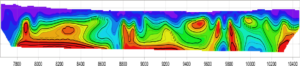 Pole–dipole surveys provide 2D section information along surveyed lines.
Ground Magnetic Survey
 This survey maps the magnetic distribution in the earth’s crust. A geometrics unit G-859 is used as rover and G-856 is used as a base unit. Data collected in continuous or discrete mode.
3D SURVEYS
 3DIP- OFFSET POLE-DIPOLE
Data acquisition is aimed at mapping structural controls to mineralization at depth. Offsets to the North and South of the potential lines helps to see deeper structures, shear zones etc.
Ground Water Exploration
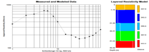 Vertical electrical soundings using Schlumberger electrode array are carried out to map water bearing aquifers.